Location and Directions

• ───────────────── •
March 2021: Due to the Covid-19 pandemic, there are additional protocols for coming to the Unist’ot’en Yintah. Following Registration, folks will guide you through these precautions. Thank you for your support!
• ───────────────── •
Location
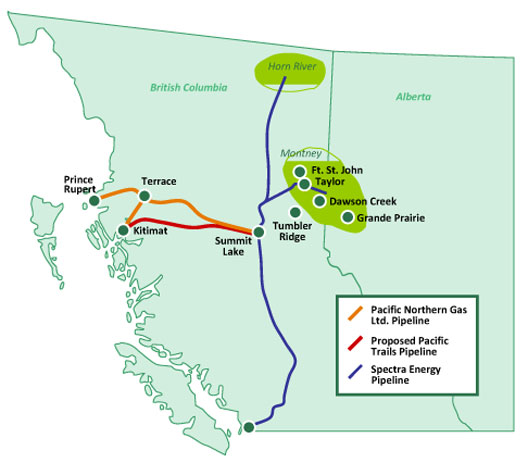
The camp is located on the shores of the Wedzin Kwah and mouth of the Gosnell Creek. These are all tributary to the Skeena, Bulkley, and Babine Rivers. The proposed pipelines from Enbridge, and Pacific Trails Pipeline (Chevron), seek to cross the river at the exact points of our Pithouse, and Permaculture Garden that was built on the Unist’ot’en Territory of Talbits Kwah.
Place names
Wedzin Kwah – Morice River, the eastern boundary of Unis’tot’en territory
Talbits Kwah – Gosnell Creek (flows into Morice River)
Tse Wedi Elh – Rocks Flowing, the place where the camp is located
Driving Directions
Making the Trip
The camp is located on a forest road 1200 km (740 mi) by road from Vancouver, BC and about 130 km from the town of Smithers. A car can make the trip from Vancouver in about 16 hours including gas and refreshment stops. Most drivers stop in William’s Lake or Prince George for the night. Due to Covid-19, we recommend camping on your way up and ask that you avoid staying in hotels or houses.
Directions
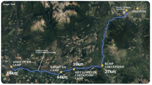
From Hwy 16 just west of Houston, the route follows the Morice River. Turn south on the Morice River Forest Service Road (Huckleberry Mine Road) just west of the Finning Equipment facility (look for the big yellow sign). Every kilometer of the forest road is marked. Near the 27 km sign, take a right to stay on the Morice River FSR. Just past the 44 km mark and a narrow bridge, turn right on the Morice West FSR. The camp is another 22 kilometers at the 66 km point from the highway. (Tip: If you are going away from the river, you are going the wrong way.)
Driving on the Logging Road
Watch out for oncoming trucks and heavy machinery. Keep headlights on at all times, stay well to the right, honk and yield at blind corners. The camp hosts suggest coming in the evening or on the weekend, or following behind a logging truck or another vehicle with a radio as they know when another truck is coming and when to pull off to the side. Radios are available for rent at Tower Communications in Houston. Please screenshot the directions and call camp to let them know your departure time before you leave Houston. You will lose service about 4km up the road, and will not have it again until you return from camp.
Current Road Conditions
(updated for March 2021)
The forest road and logging roads are generally graded and accessible to two-wheel-drive and four-wheel-drive vehicles. You will need snow tires until May, and chains are strongly recommended for 4-wheel-drive and crucial on 2-wheel-drive.
Conditions along the logging road are icy, snowy, and slushy, depending on the temperature and weather. In Spring, it can also be muddy, with washouts along the road. Drive slowly, especially on corners, and watch for work trucks. Daytime travel is strongly encouraged.
